
Kong Mu Fm
Type Locality and Naming
Mae Hong Son basin (NW Thailand), near Myanmar, north of Mae Ping Fault. Named after Doi Kong Mu, about 4 km south of Palan village (Ban Palan) and 1 km SW of the type section of the Mai Hung Fm (grid reference 872061, map sheet 4547-II); Mueang Mae Hong Son district where the type section is located. The formation crops out above a cave and extends up to the summit of Doi Kong Mu. Lowest formation in the Huai Pong Gr.
Synonym: หมวดหินกองม
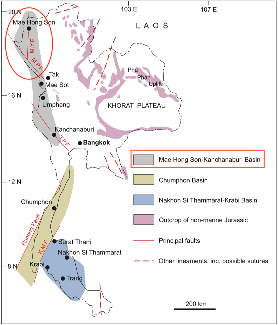
[Figure: The three sedimentary basins in which the marine Jurassic occurs, and their relationships to the main faults which might subsequently have displaced them (MYF, Mae Yuan Fault; MPF, Mae Ping Fault; TPF, Three Pagodas Fault; KMF, Khlong Marui Fault). The main outcrop areas of non-marine Jurassic rocks are also shown. In some areas, particularly on Peninsular Thailand, the Jurassic succession contains both marine and non-marine facies (redrawn from Meesook 1994; Charusiri et al. 2002, by Meesook A. & Saengsrichan W., 2011, Page 152).]
Lithology and Thickness
Sandstone. Mainly fine- to medium-grained arkosic sandstone with slightly calcareous cement in the lower part (grading up from the underlying sandy limestone of the Mae Hung Fm). Thickness: 65 m
Relationships and Distribution
Lower contact
Grading into sandy limestone of the underlying Mae Hung Fm. Further north, the formation is conformably underlain by the Pa Lan Fm, and consists there mainly of fine- to medium-grained arkosic sandstone.
Upper contact
Not given
Regional extent
Mae Hong Son basin (northern part of Mae Hong Son – Kanchanaburi Basin); Northern Region: Mae Hong Son and Tak provinces
GeoJSON
Fossils
"Fossils are rare, however, and only plant remains have been found so far. On stratigraphic grounds its position lies conformably above the Toarcian – Aalenian Pa Lan Fm (Pa Lan Fm) and Mai Hung Fm, indicating that it is Aalenian or younger." (Meesook & Saengsrichan, 2011)
Age
Depositional setting
Shallow marine, neritic zone
Additional Information